An Accidental Tourist Pacific Coast Highway Road Tour
“Some men don’t like to be taken for a ride”
~ James Bond, Thunderball, 1965
Travel Paths
If you’re like me, you’ve figured out a way to visit the west coast at least once in your life. As a child, Grandma Jones boarded her first aircraft in the late 1960’s to see Uncle Jim and Aunt Loleta in Sacramento. This was a big deal, as I (and the Jones clan) vividly saw her off at the airport in Newport News, VA. Fast forward 50 years when I made my first trip to Los Angeles in 2007 for a rendezvous with my west coast 1st cousins (Uncle Jim’s sons), Mark and Daryll Jones. For all audiences, let’s just call it memorable and leave it at that. The “hook” was set and I became a California dreamer ever since.
In the years to follow, LA fell out of favor. For me, the Los Angeles region (Beverly Hills, Santa Monica, Malibu, Compton, etc.) is an area of distinctly different “haves” and “have-nots.” Mostly though, it’s a place for the young or the “new” rich, unless you’re a generational local familiar with the subtle nuances of each zip code. In the following years, I began to embrace the Bay Area and it’s distinctly northern California lifestyle. While very expensive to reside there, the people are much more relatable and the surroundings, worth exploring. Who doesn’t like the Golden Gate Bridge, Point Reyes, Palace of the Fine Arts, Embarcadero, Napa, and of course the northern Pacific Coast Highway?
The Pacific Coast Highway
The Pacific Coast Highway begins north of the Mexico border north of San Diego and mostly straddles the coast for 659 miles, taking a slight easterly trek through the Redwoods National Forest and then to the Oregon state line. There, it takes on a different name and extends to and through Washington State. I’ve been confused, why the 3 states could not agree on calling it one name? This continuous highway directly or indirectly is linked to the Pacific Ocean. In Washington, it’s called the Pacific Coast Scenic “Byway.” Seriously? This visual narrative is about a short stretch of the highway between Pfeiffer State Beach, north to Pigeon Point Lighthouse. Where should we begin?
Wheels Down, San Jose
Trying to avoid the hustle of San Francisco’s airport, I sought out the southern Bay Area comfort of San Jose. It was a good choice. The airport there is smaller, people friendly, and at a better price point than it’s big city cousin. An interesting fact, since many of the nation’s top (and lucrative) tech firms are based here, and just an Uber ride away from San Jose. Picking up my rental car was uneventful. Next stop, Monterey. Jumping on the 101 is fairly easy and the drive, beautiful. You quickly pass towns like Coyote, San Martin, and Rucker, before approaching the pacific ocean at Neponset. Then on to route 1 (Pacific Coast Highway) entering Monterrey from the north roughly 90 minutes away from San Jose. Along the way, scenic views of California’s heartland where all types of produce were in various stages of growth.
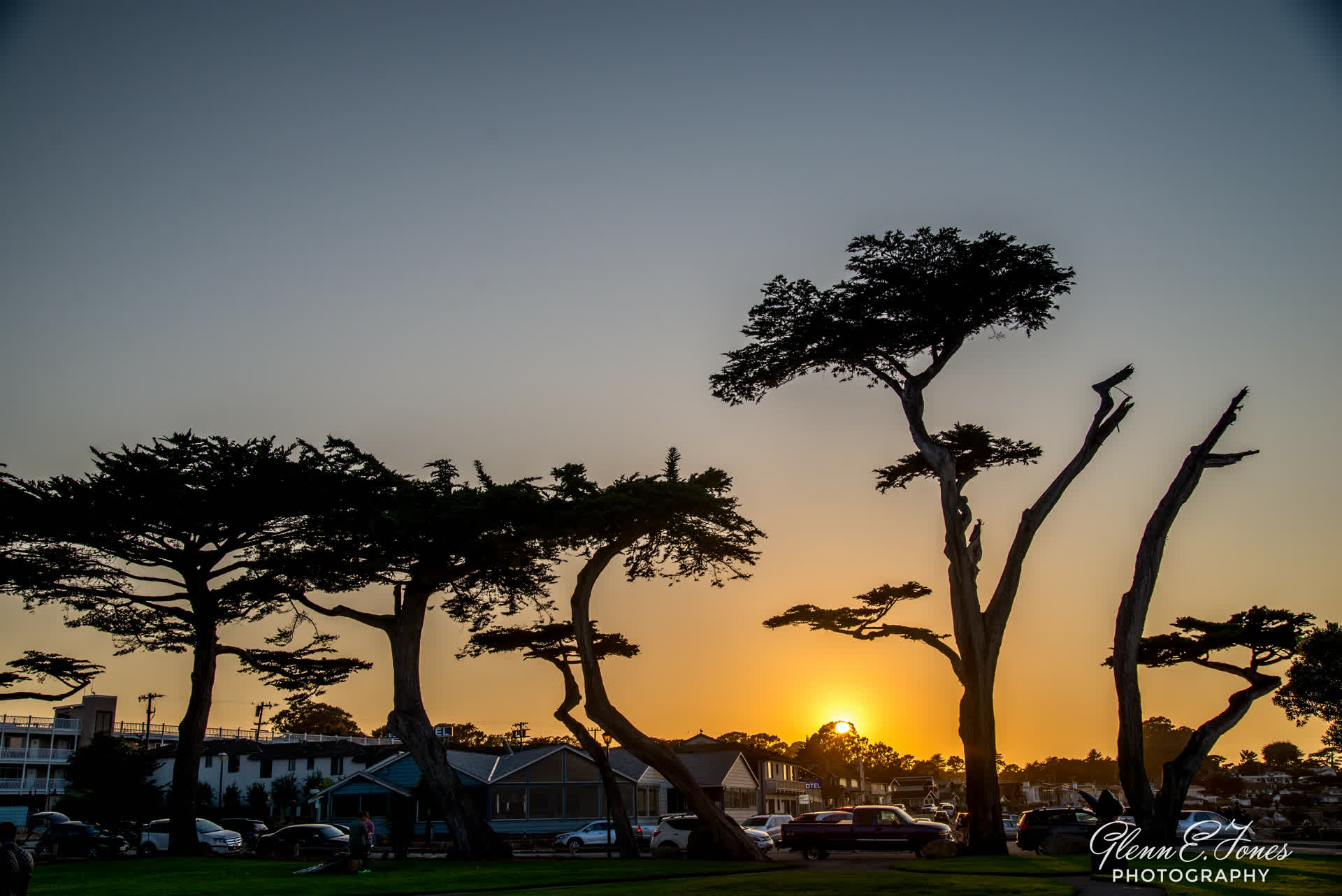
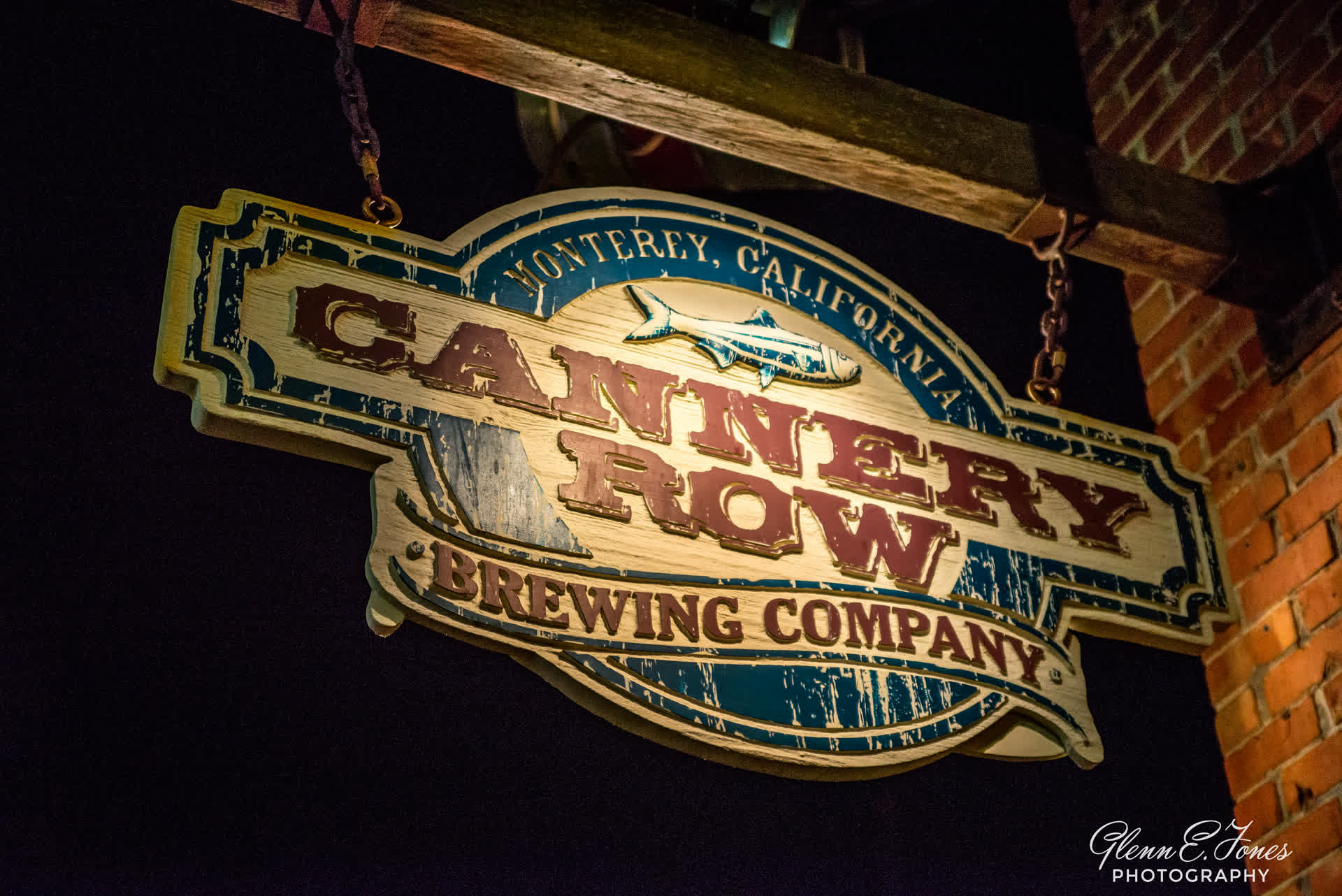
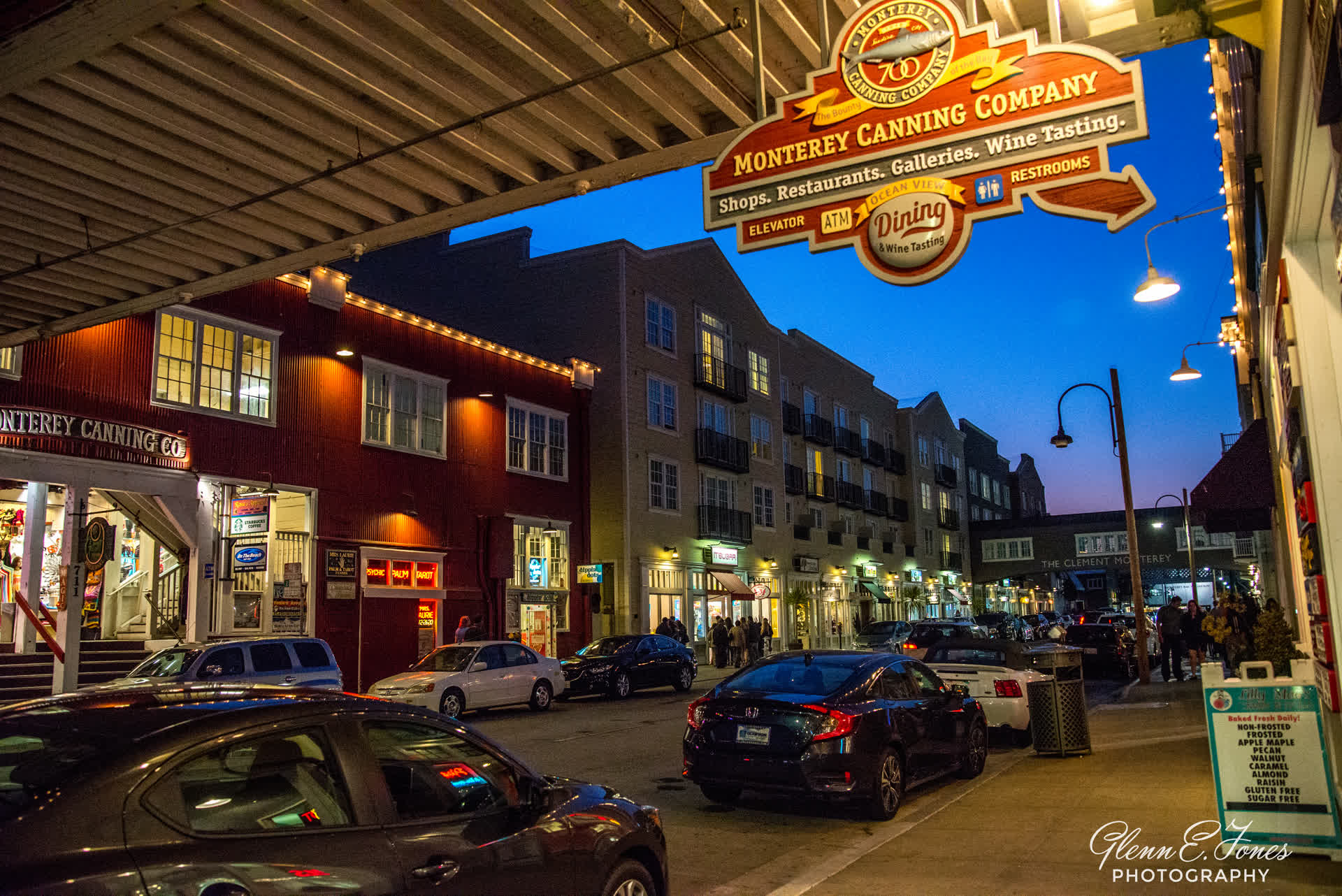
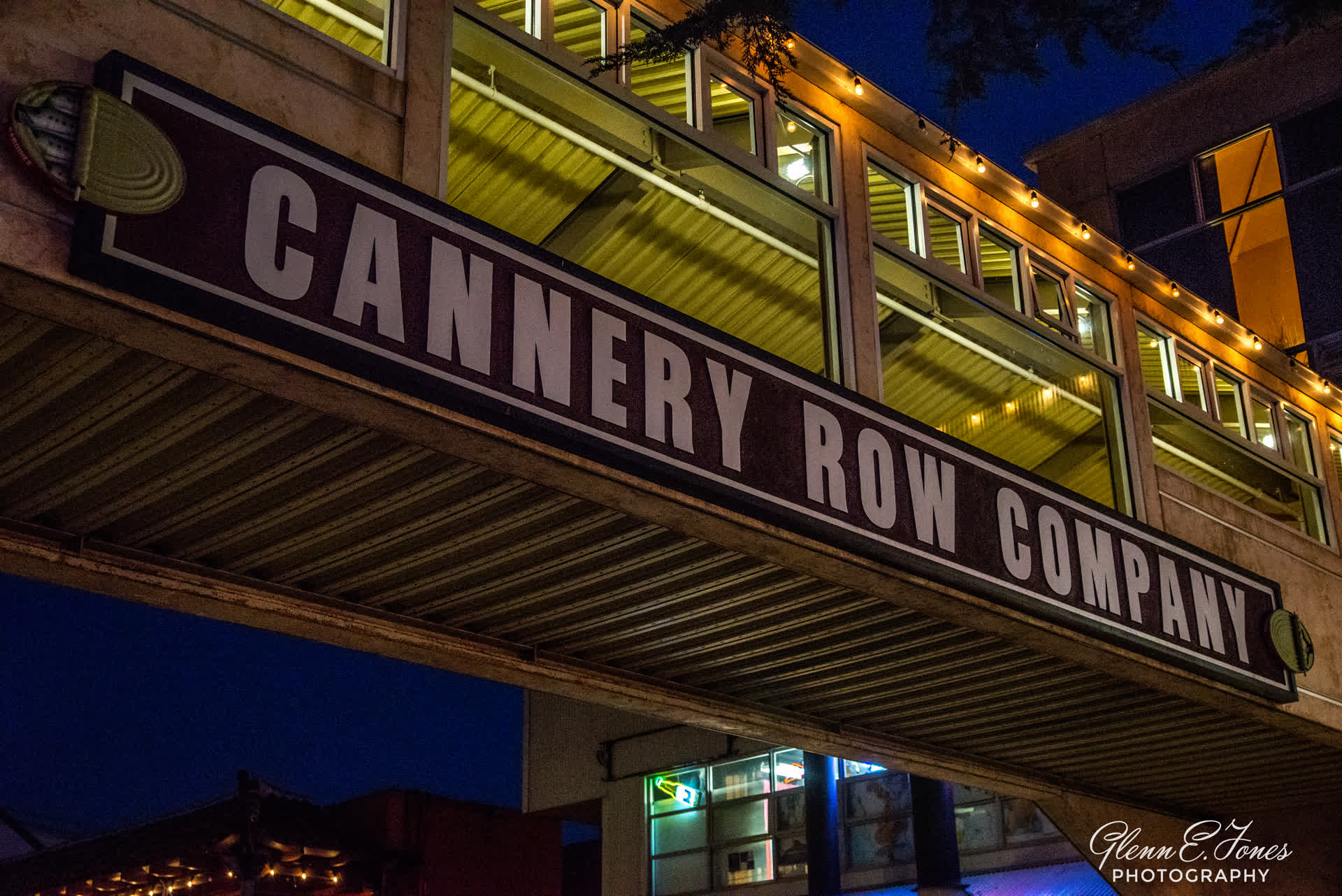
Monterey
Monterey is a city on California’s rugged central coast. Its Cannery Row, one-time center of the sardine-packing industry, was immortalized by novelist John Steinbeck. Today, it’s a popular strip of gift shops, seafood restaurants and bars in converted factories. Also famous, the Monterey Bay Aquarium, with thousands of marine animals and plants on display in underwater and interactive exhibits. Turning into the area, I am immediately struck by the view of the Pacific. Driving past the marina, the energy of the vibrant small town begins picking up. To my left, is the Presidio. It is an active US Army installation with historic ties to the Spanish colonial era. Currently, it is the home of the Defense Language Institute Foreign Language Center. It is the last Presidio in California to have an active military installation. Driving on, I find my hotel, ditch my bags and then drive off to the Pacific Coast Highway, heading south.


18 Miles Per Hour
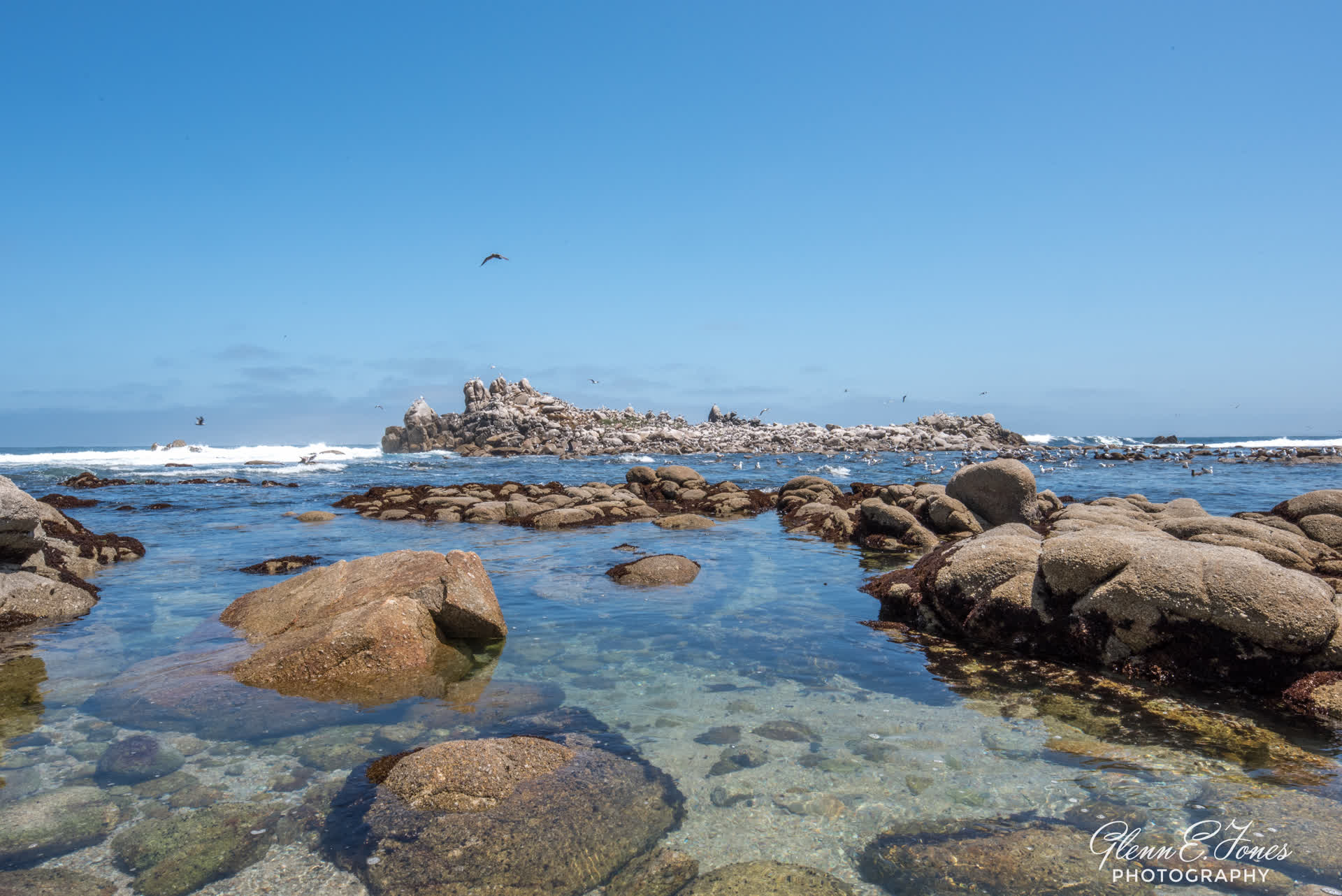
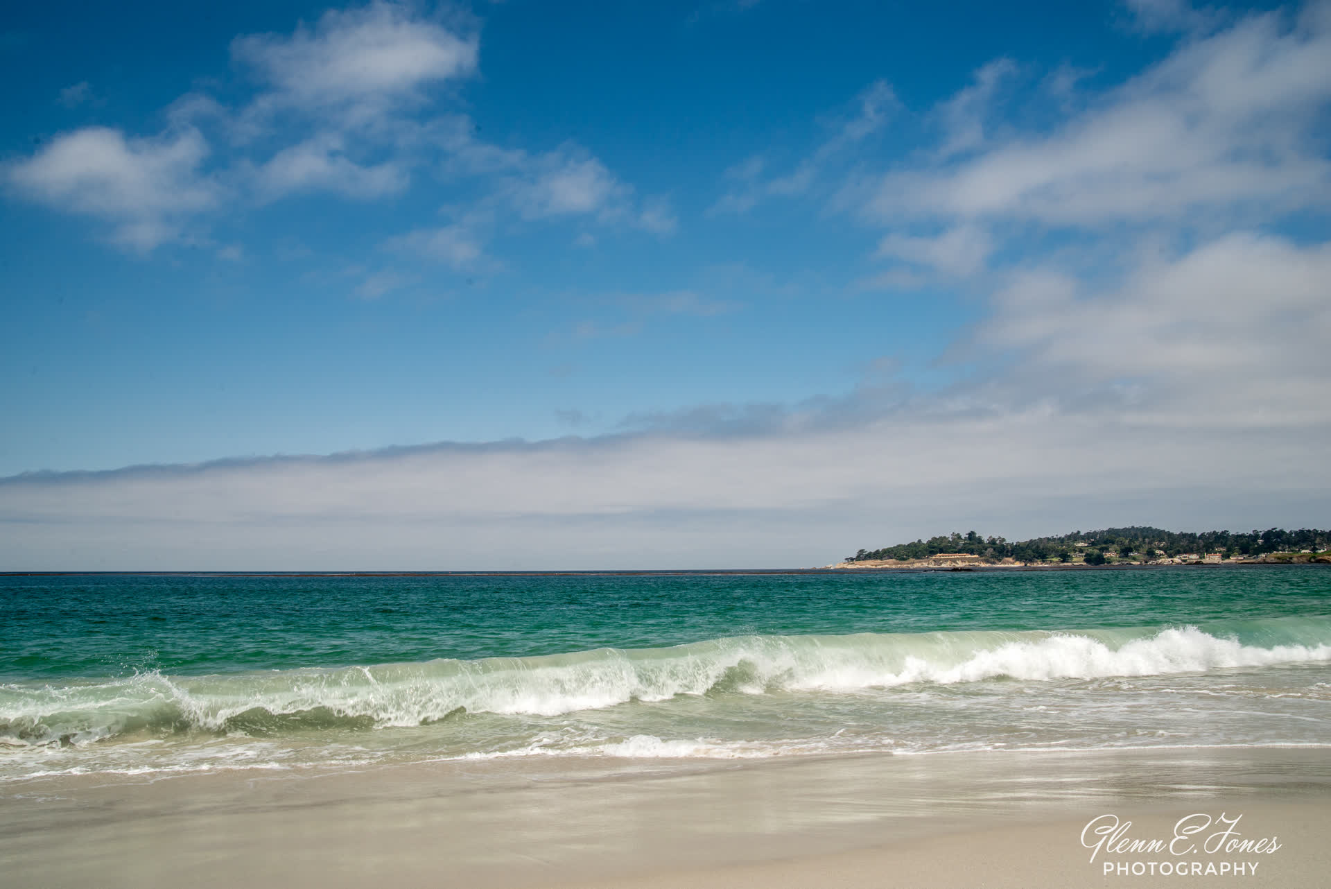
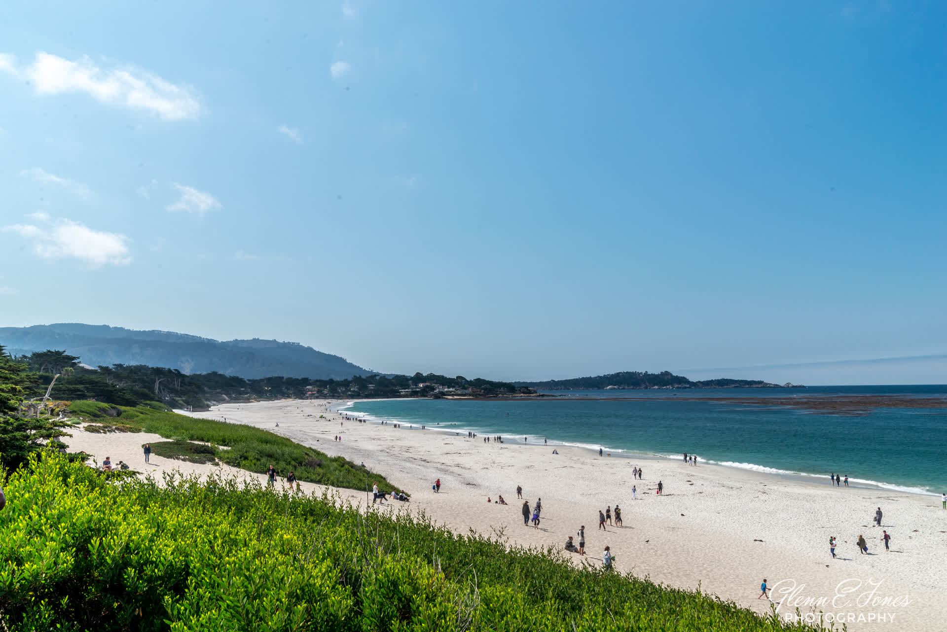
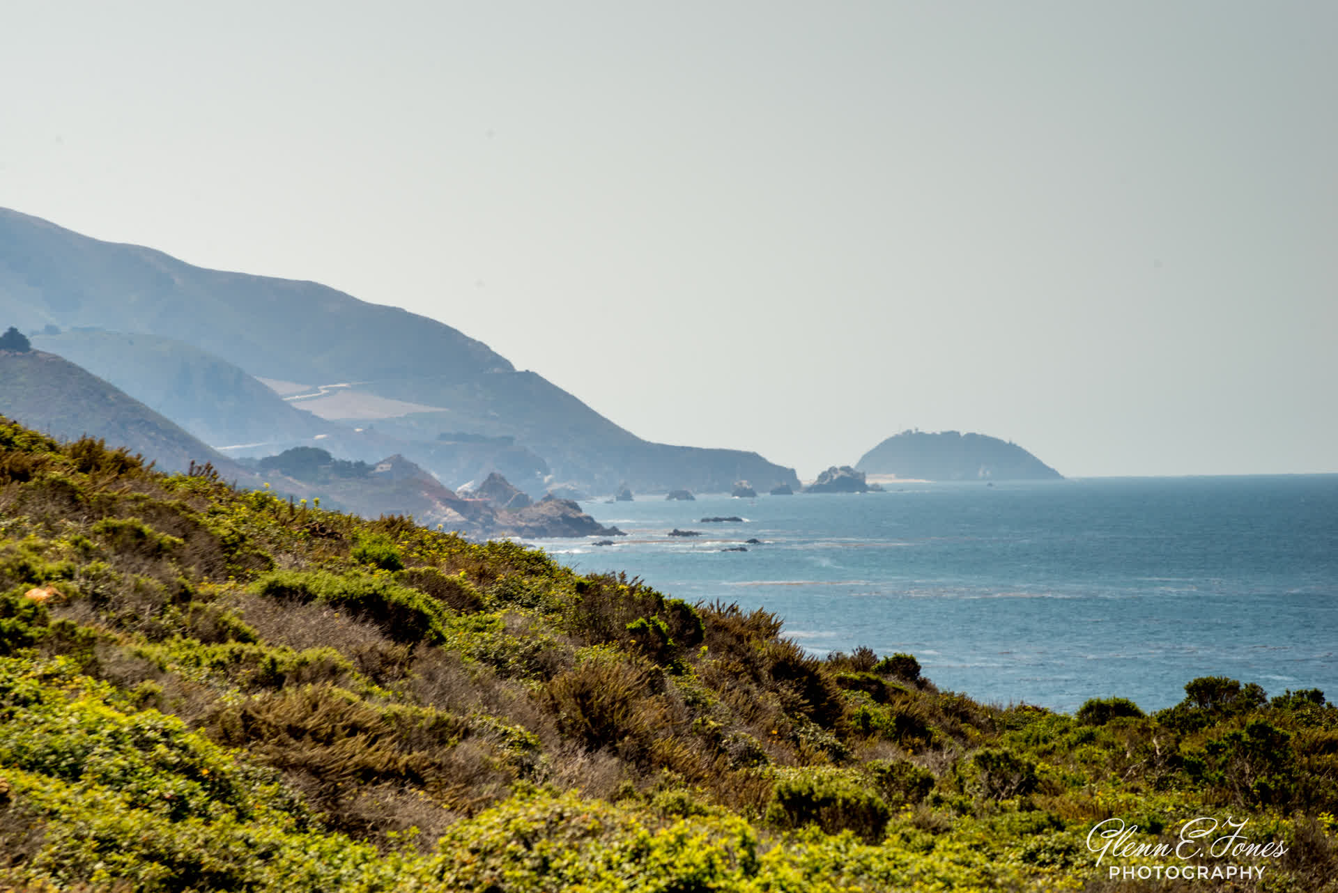
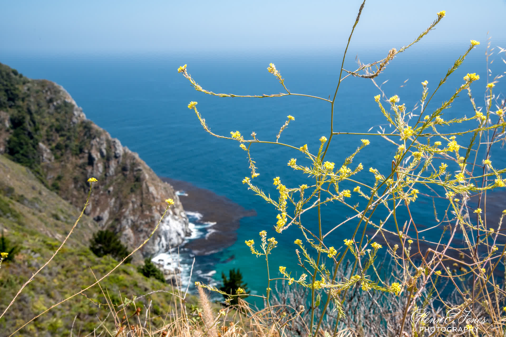
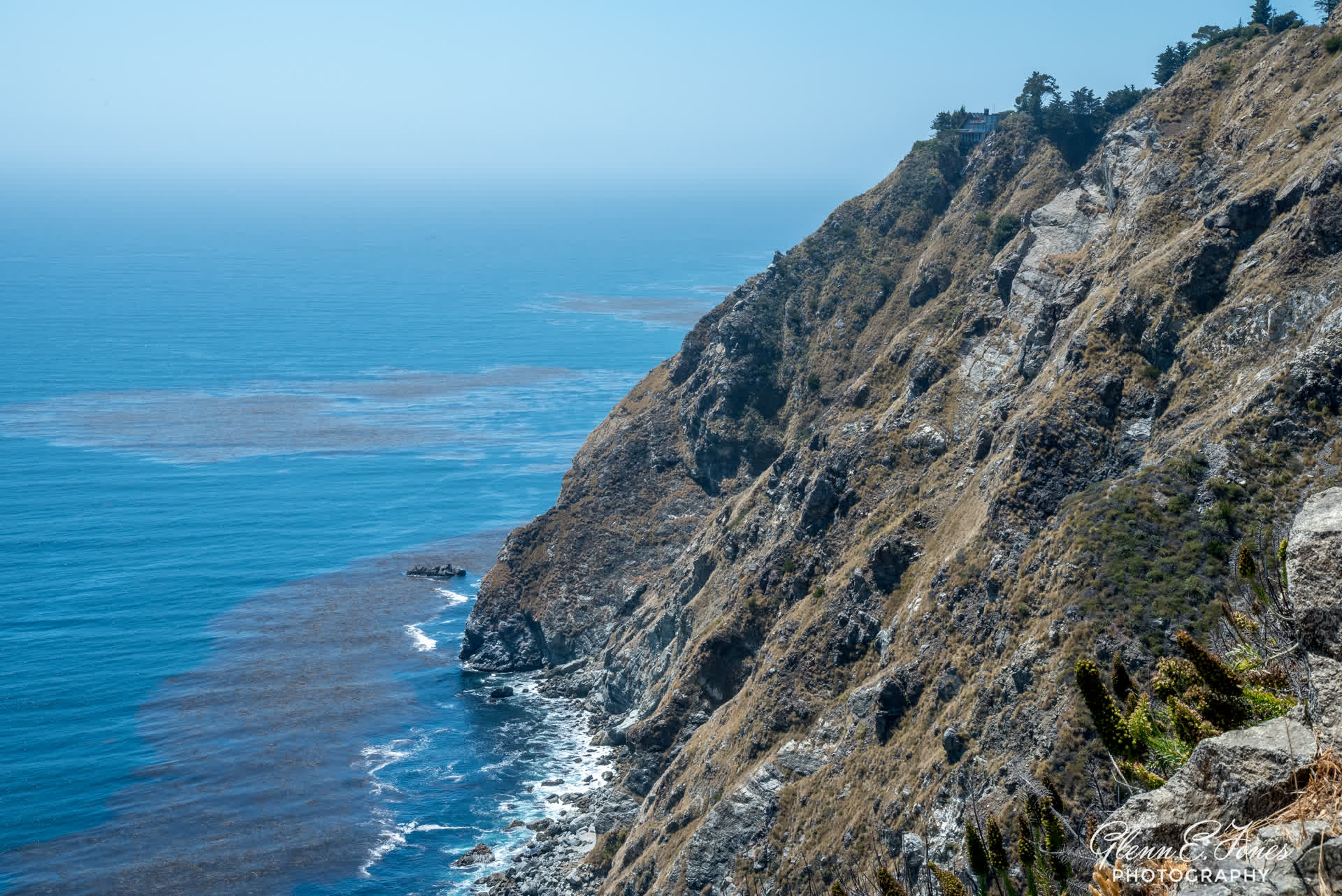
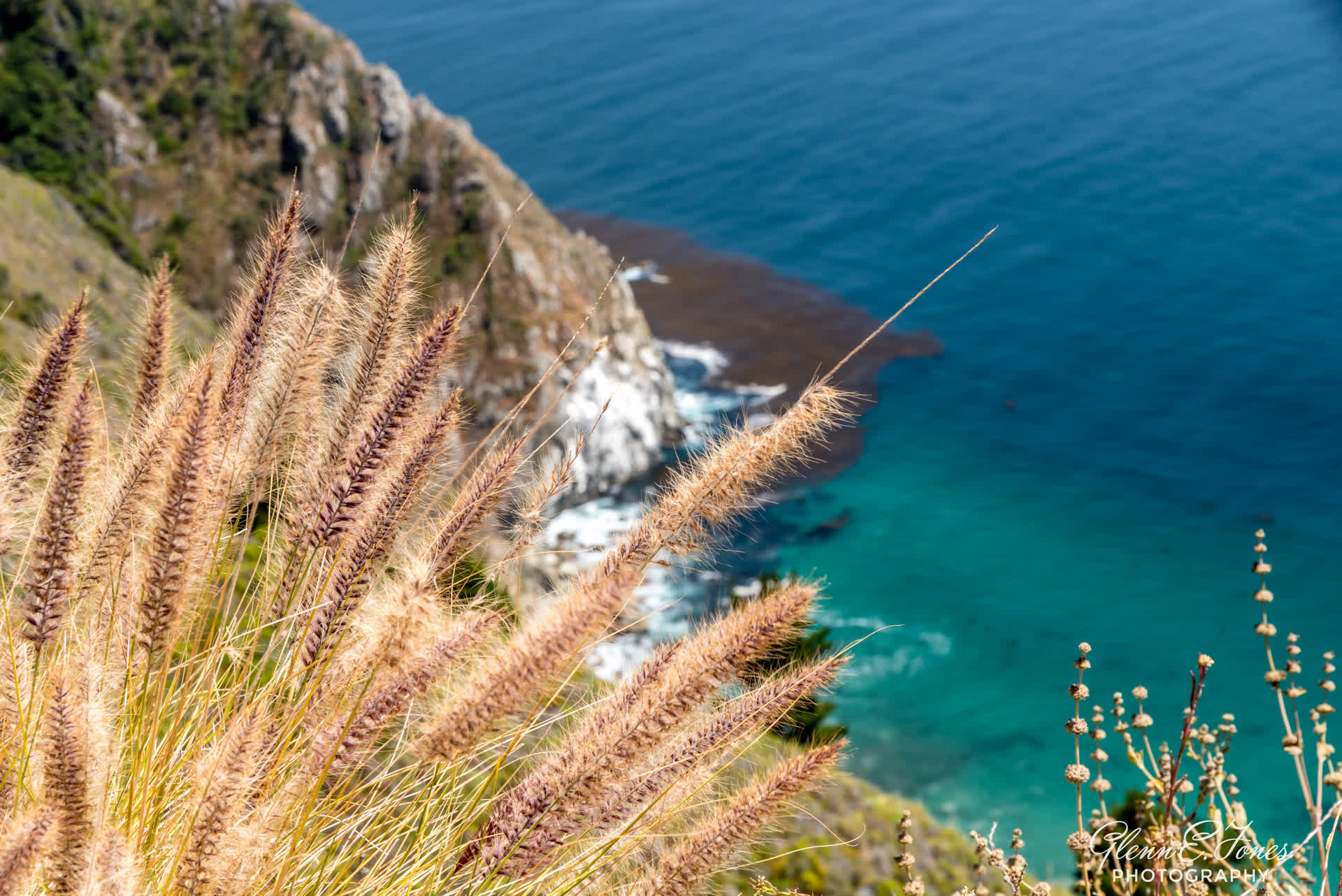
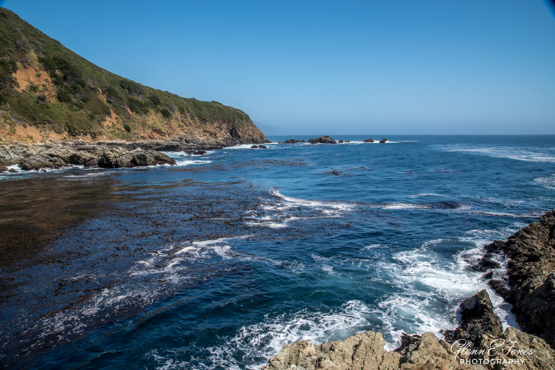
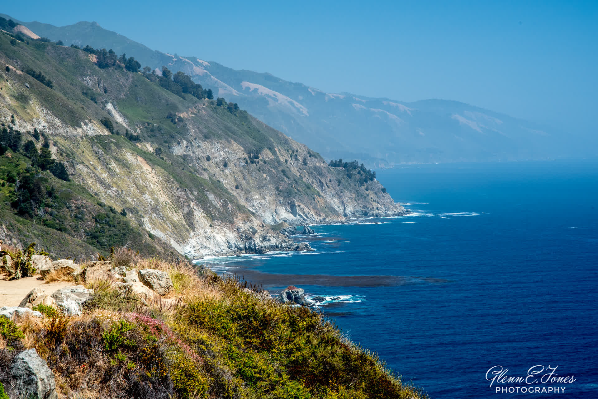
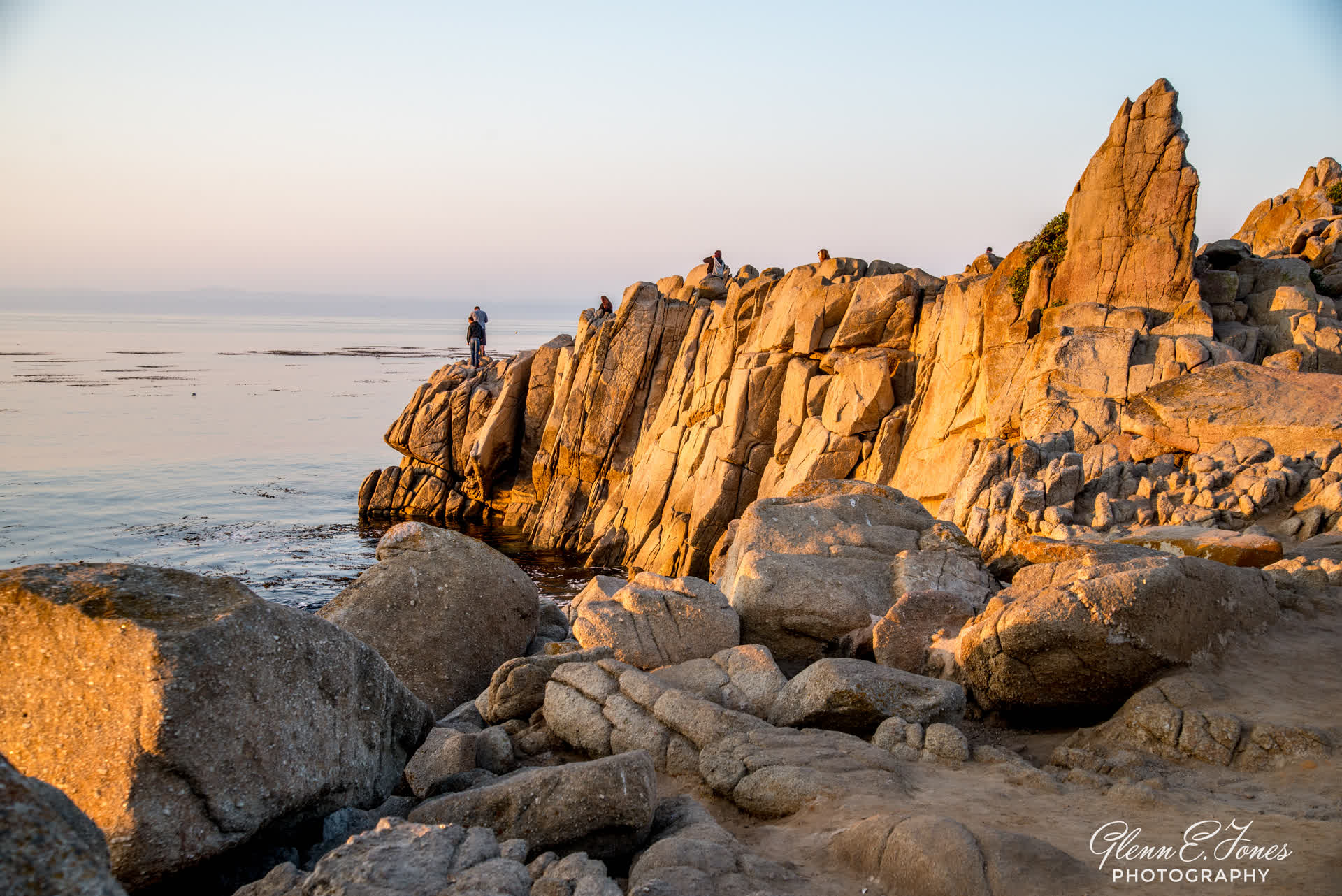
Leaving Monterey and driving south is a slow but beautiful drive. Moving past Lovers Point Park brought back memories of another time from another life. It was a momentary flashback. A short lived memory that faded as I rounded Point Pinos Lighthouse and meandered through Asilomar State Marine Reserve. Here, the rocky coast weaves in with brief sandy beaches. The surfers and beach lovers soaked up every available parking space and roadside patch of grass. It’s a small, but popular area. This route to the PCH takes you near the famed community known as Pebble Beach. Here, you aren’t allowed to drive through as this is a “gated town.” One of these days, I would love to drive the famed “17 Mile Drive.” But I’m thinking I may need an invite, the one that rarely comes. I’ll get back to you on that one day. Just beyond Pebble Beach is the also famous community called Carmel by the Sea. It’s a great town with a wonderful beach, great dining, and generally nice people. Leaving this town, I pick up U.S. route 1 (PCH) and begin the real trip south. It’s roughly an hour to Pfeiffer Beach. The drive though, is slow. The curves are treacherous and if you’re nervous about heights, you may want to turn back in Monterey. This drive is for the grown ups and not for the teen driver or the faint at heart. I stopped several times along the way, remembering not to go to close to the edge when peering down the cliffs.


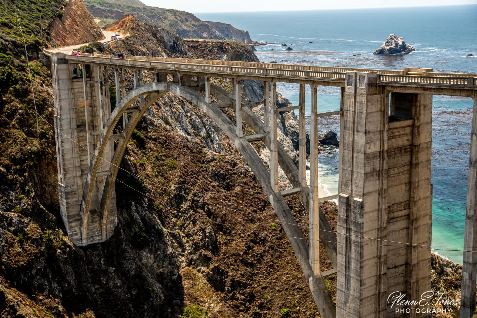
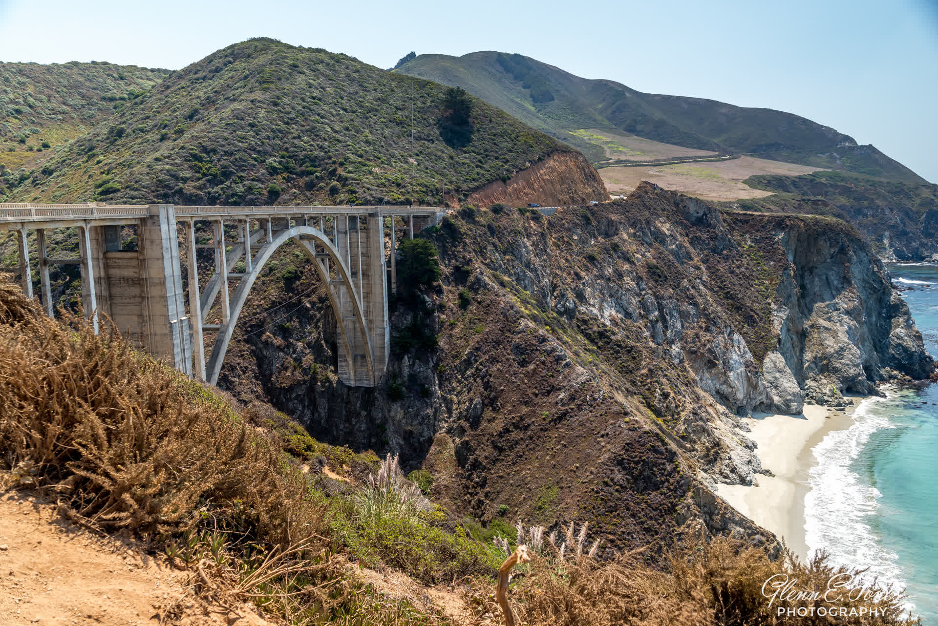
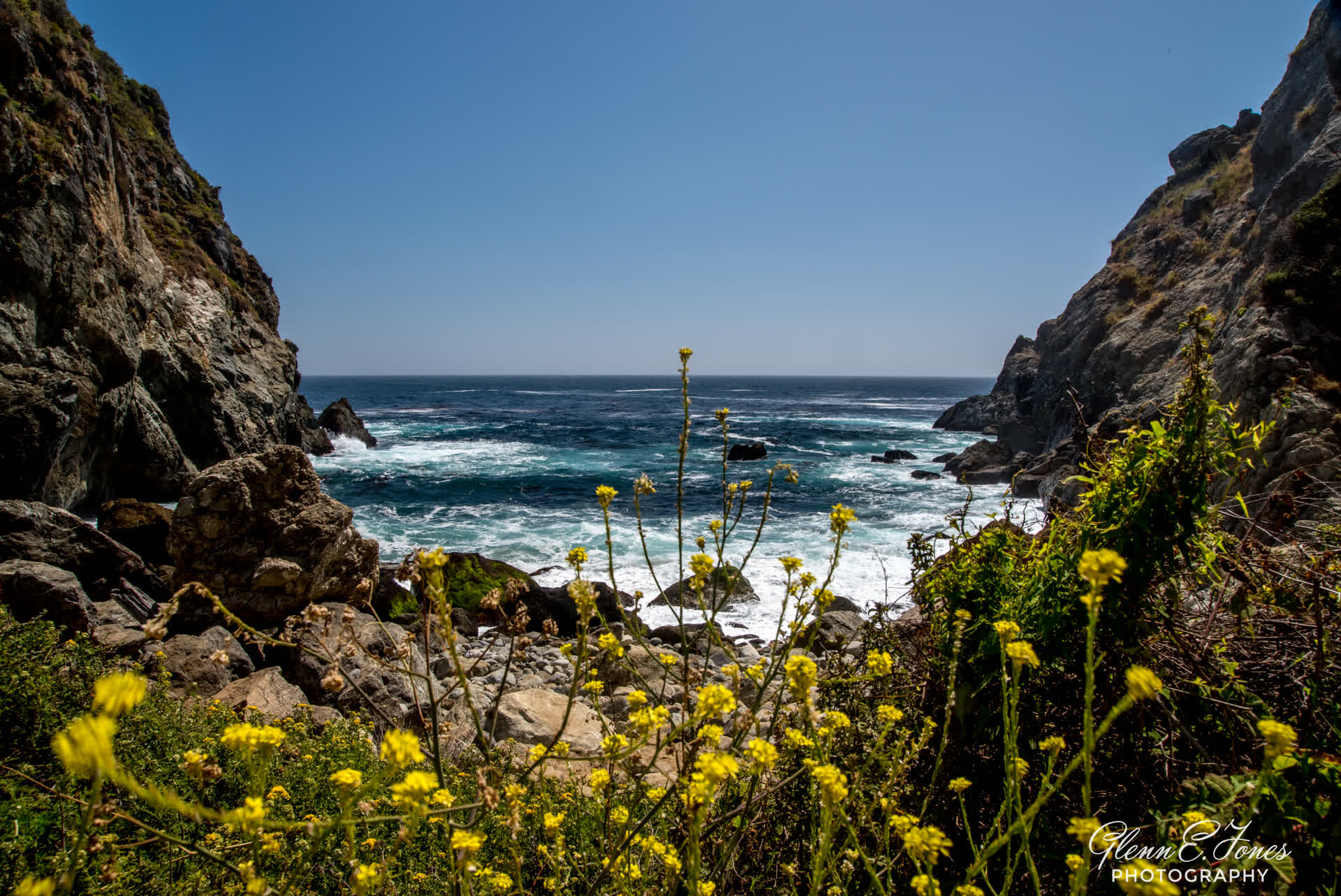
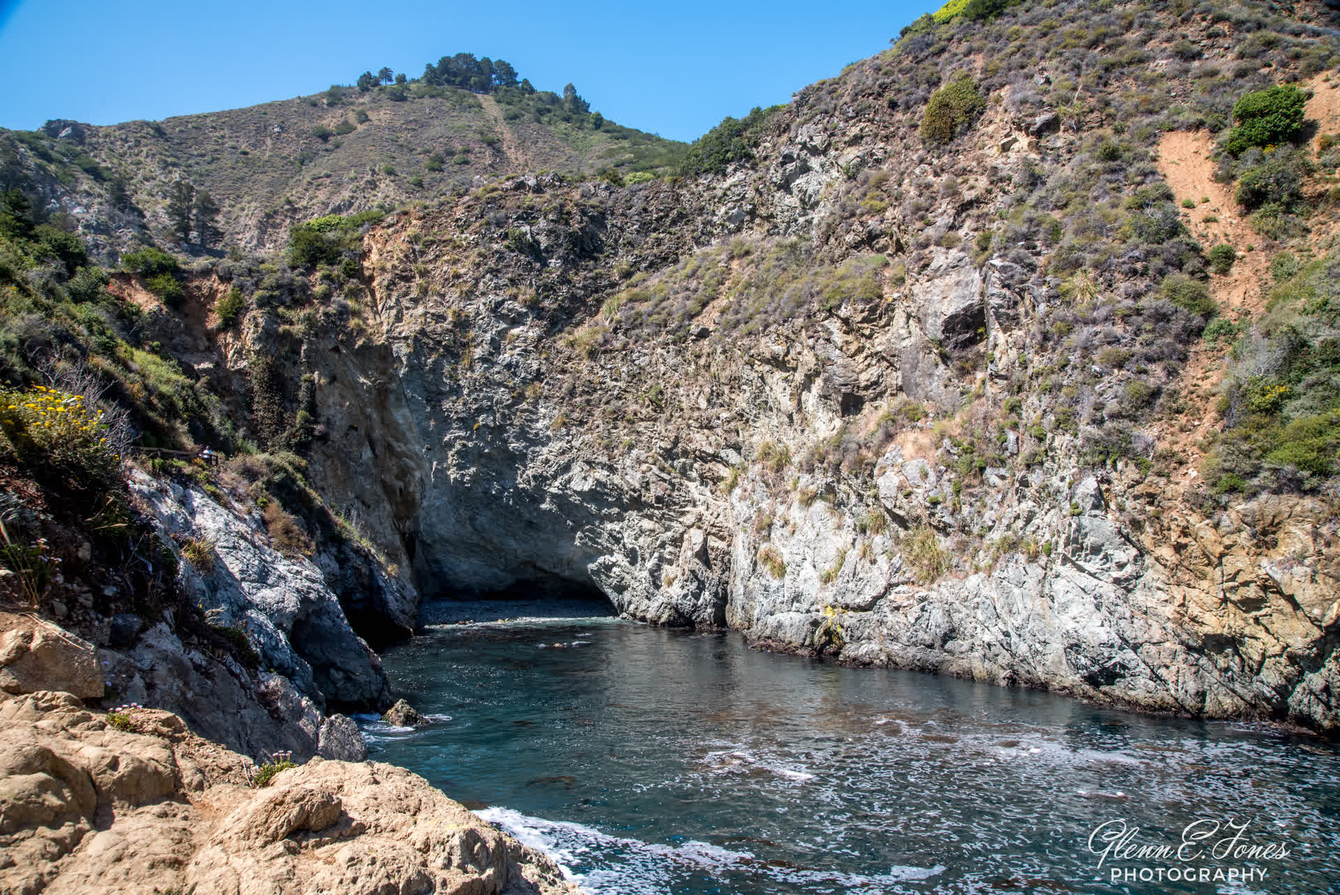
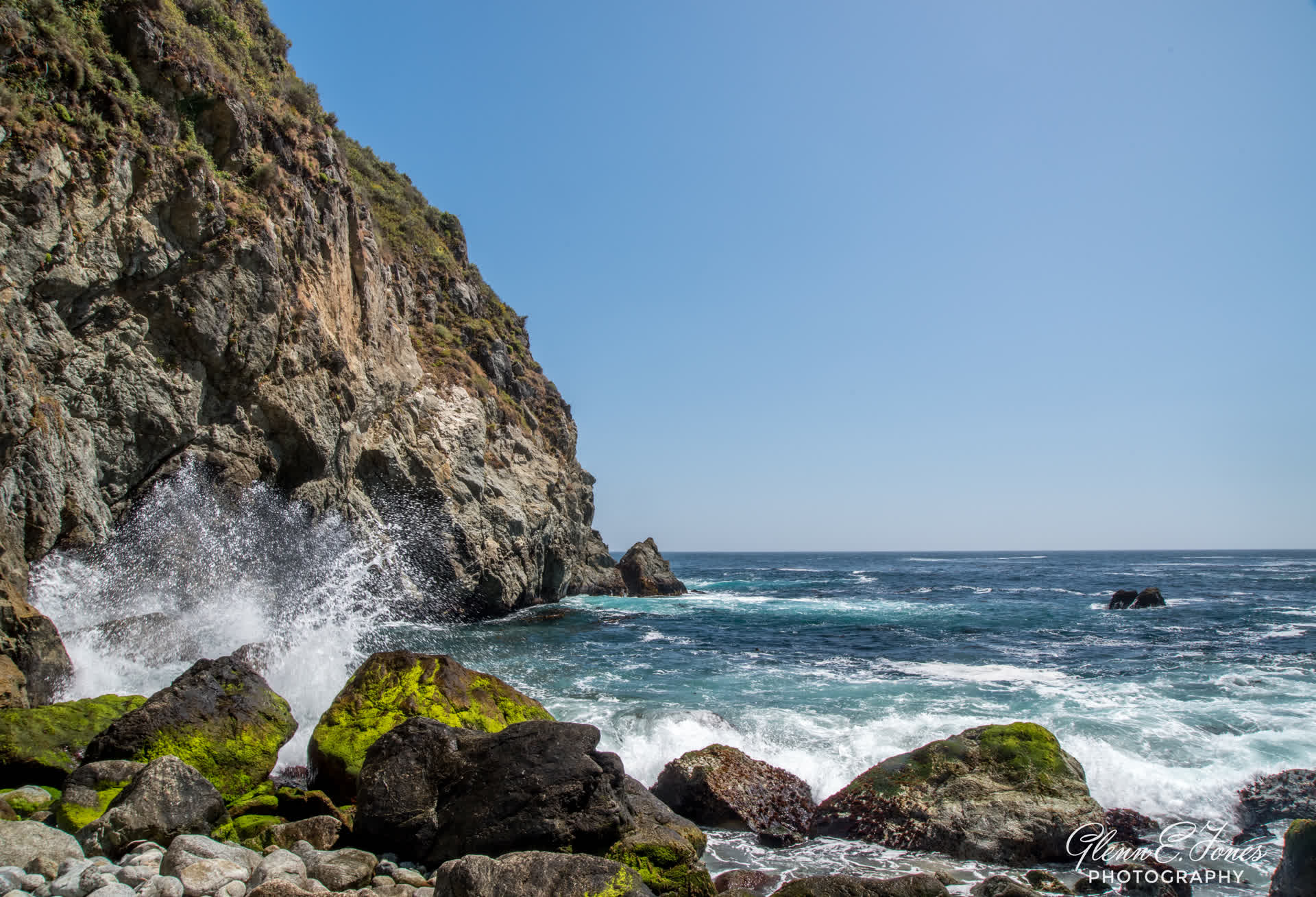
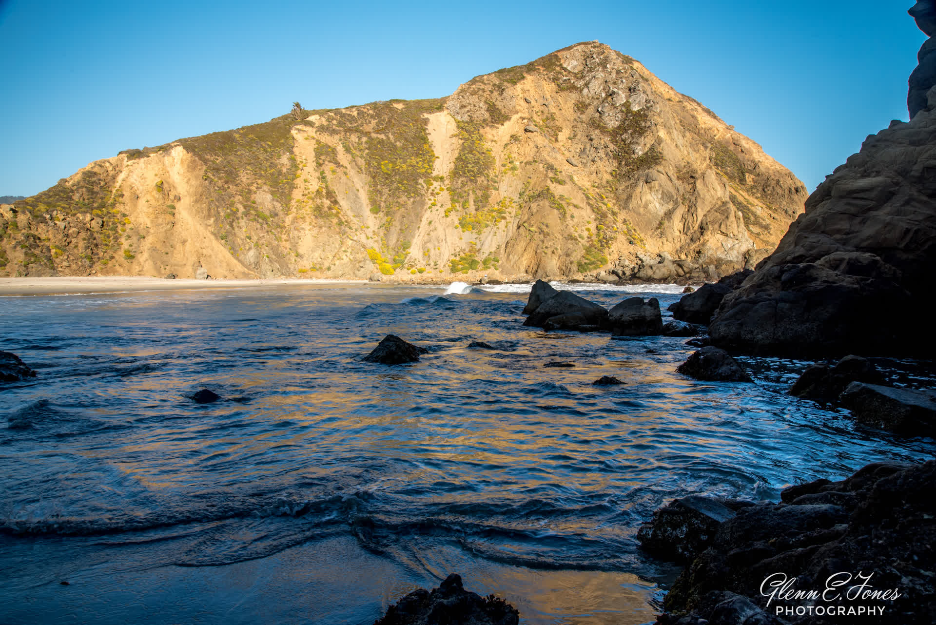
The next major stop was the Bixby Bridge. Some of the most iconic photos of the PCH are taken here, both day and night. Some people (brave, not very bright, down right stupid) climb to the bottom of this rugged abyss. I imagine the beauty at ocean level is indescribable. I also suspect falling to your death is too. I’ll pass, thanks. A few miles down the road, I do decide to follow a path to crashing ocean below. It’s about and 18 degree walk down a curvy (but maintained path). As I get about ⅓ down, I do notice people walking back up the path. It’s not a good look. They are out of breath, red, holding their waist at every turn. I begin telling myself I should have stayed in the car. But in front of me, is an amazing site. The tide was coming in and the surf was crashing over rocks. Standing there, I tried to soak in this moment as much possible. We often forget the details in much of what we see, and I didn’t want this moment to ever fade. Walking through a nearby cave, I discovered another cove which appears to have once harbored small ships sailing along the coast during another time. I chatted briefly with a couple from Norway. Leaving this beautiful place, it was time to make my way to the top of that hill, and back to my car. The path, daunting, with no shade and so it begins. For the next 25 minutes, I leaned forward, tried not to waste energy, and make my way to the top. There, I drank a bottle of water and fell asleep in the car. Pfeiffer beach was still 15 minutes away, and I was hoping to get there just before sunset.


Destination: Pfeiffer Beach
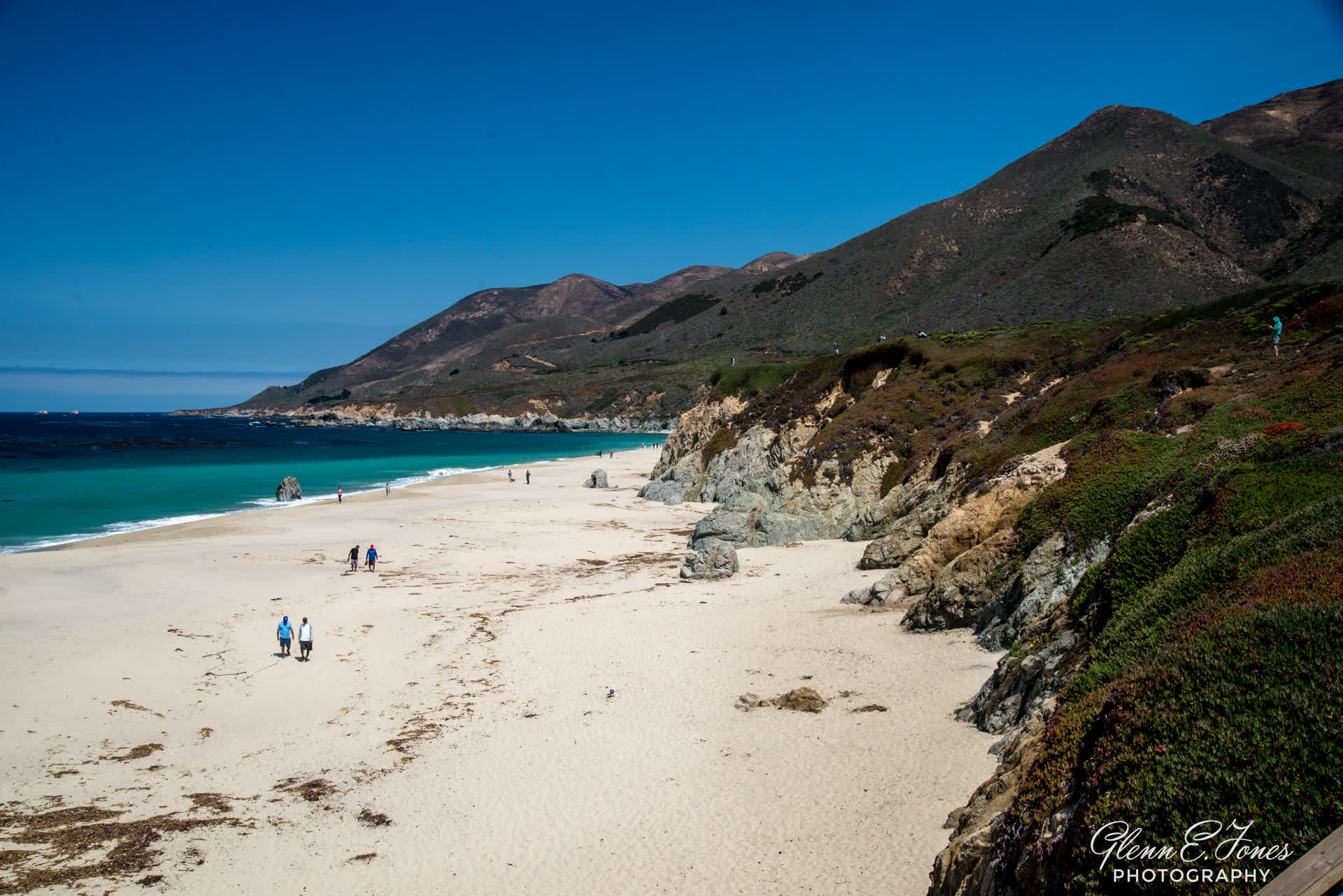
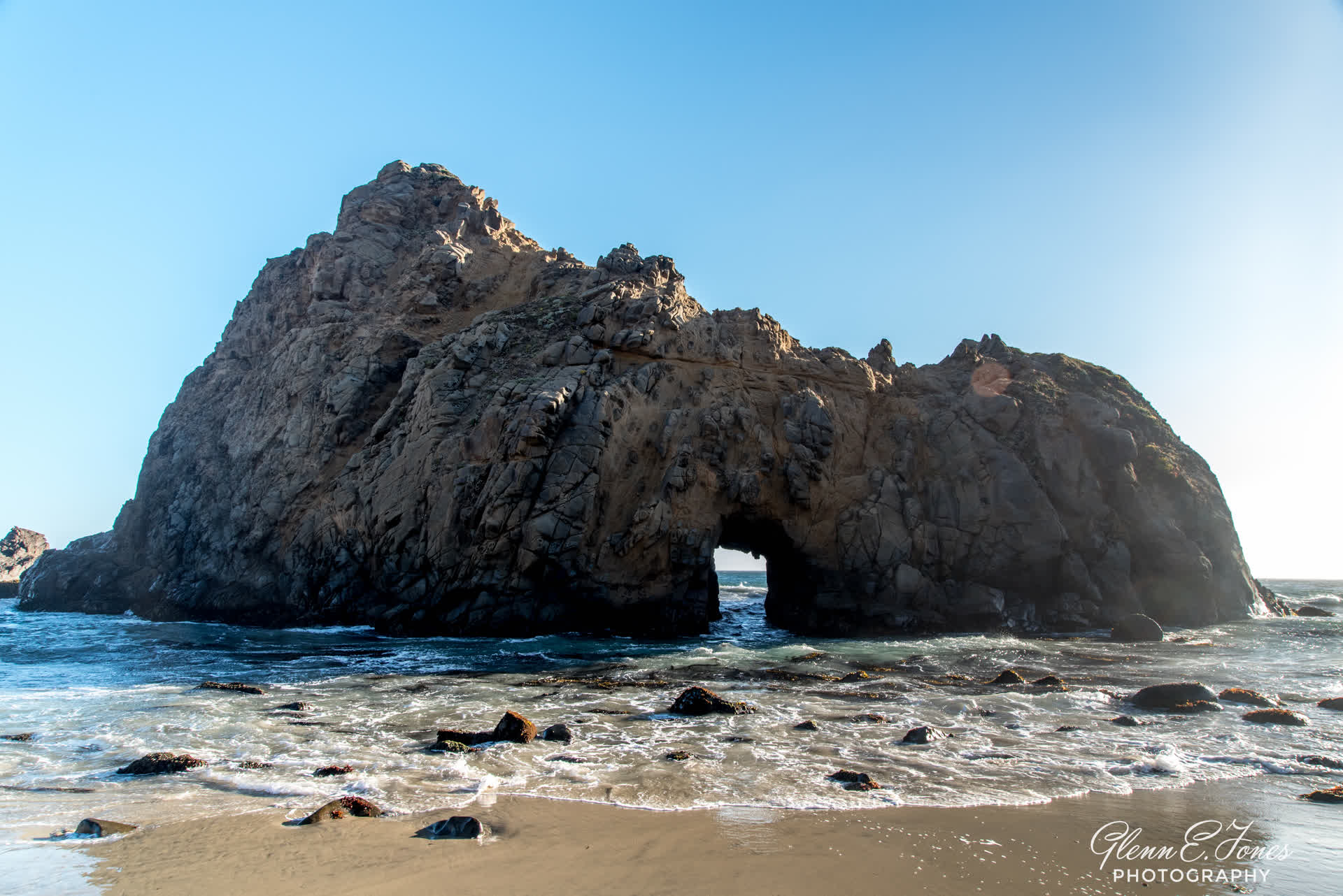
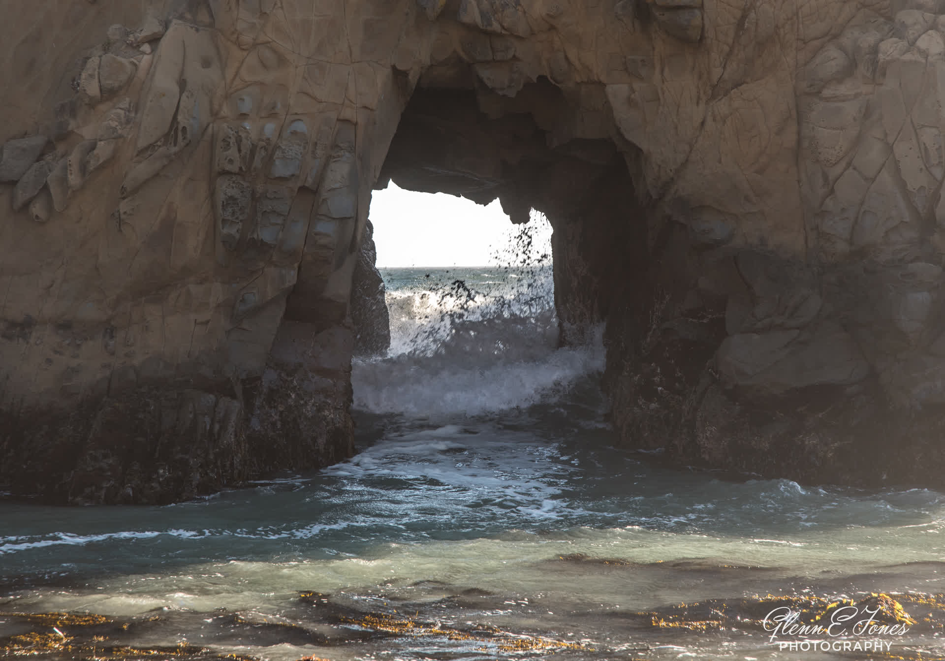
Finding Pfeiffer Beach was tough enough, getting access was even more difficult. Driving to the gate three times, I was told to come back as the parking lot was full. With plenty to see around the area, it was all good. After about an hour of driving around, my car was finally waved in. Quickly grabbing my camera gear, it was a fairly short walk to the beach. Clearly, this was a popular national and international destination. Wandering the shore, and locating the best areas, I took a few photos. Once a year around Christmas, the sun sets directly behind the open rock channeling an amazing sunbeam. Clearly, a beautiful sight. About this time, the international tourists began asking for group photos with their cameras. First one, then seven. They were on a North American tour from China. A very nice group, indeed. I finished the last of my photos, packed up my gear, and made my way back to Monterey. The drive back was quiet, as the sun was now below the horizon, NPR was a repeat, and my mind was on dinner and then bed.


Northern Adventures
After a good night’s sleep, I wandered into town for breakfast and a bit of park bench time along the waterfront. The fog was quickly burning off, leaving a wonderful day in the making. Below, the seals were frolicking about and ignoring the locals. An Iowa couple I met, shared they’d seen a couple of whales just offshore. Me: I didn’t see a thing.
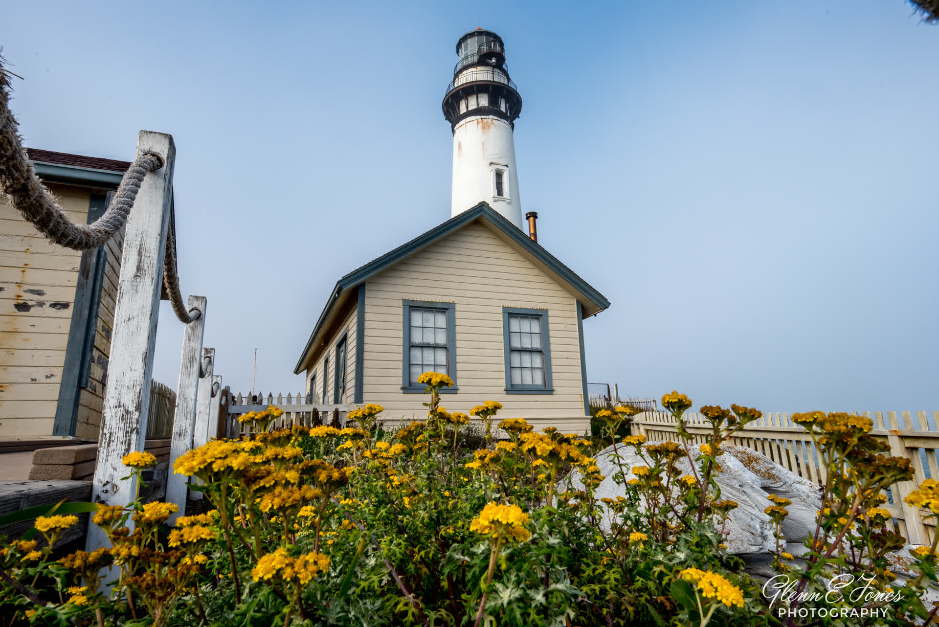
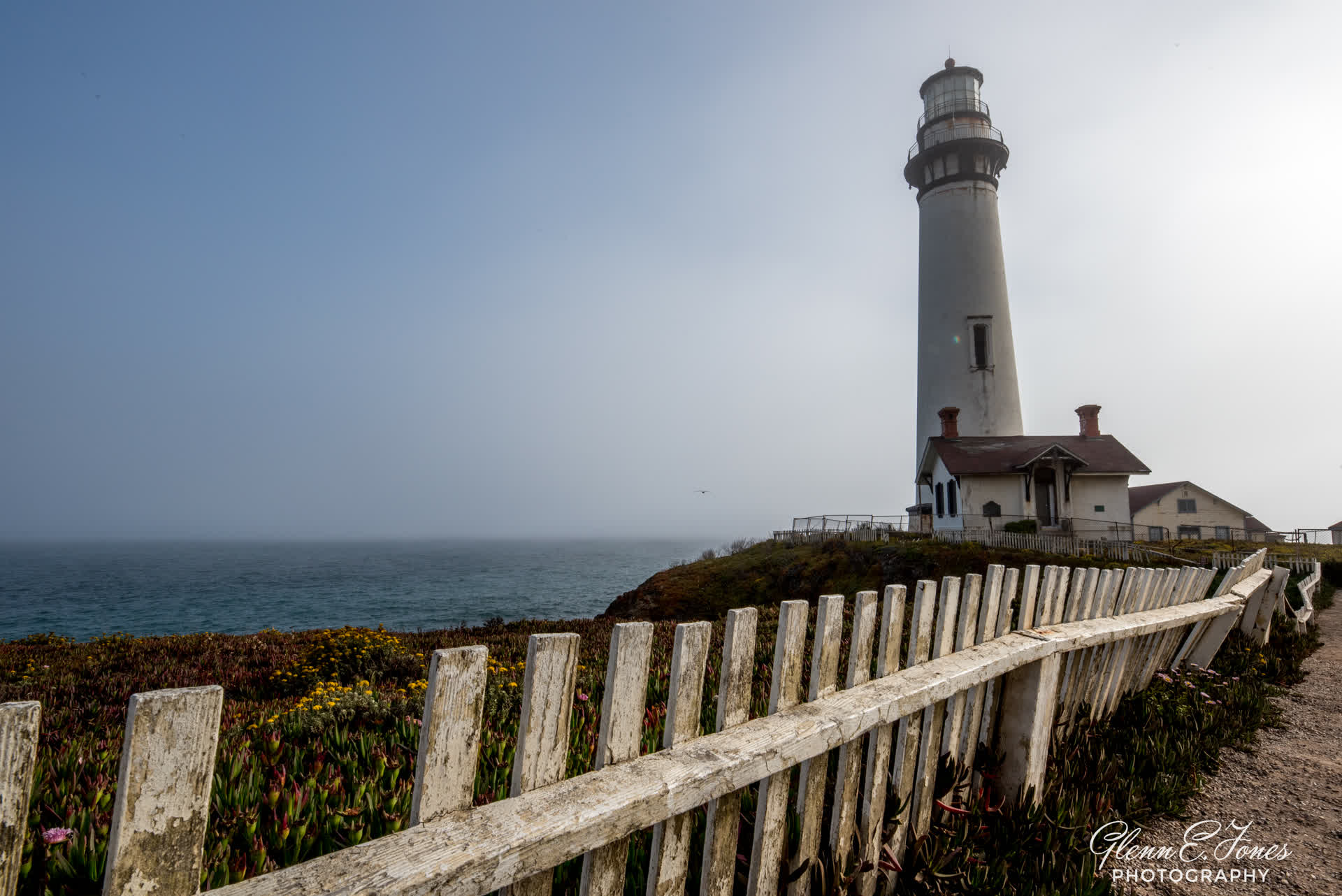
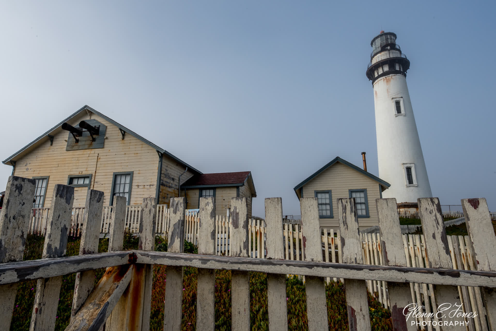
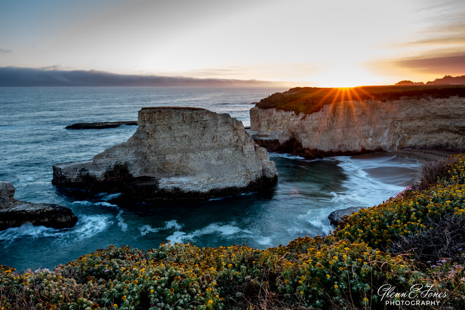
Fast forward past lunch, a few hours napping, and a 90 minute drive north, and I arrive at Pigeon Point Lighthouse, on the northern end of this weekend excursion late in the afternoon. I choose rest after learning a thick marine layer (kinda like fog) would move in just after noon and was forecasted to remain along the coast for several hours.
Perched on a cliff, 50 miles south of San Francisco the 115-foot Pigeon Point Lighthouse, one of the tallest lighthouses in America, has been guiding Mariners since 1872 it’s five-wick lard oil lamp, and first-order fresnel lens, comprised of 1,008 prisms, was first lit at sunset November 15th, 1872 the Lens stands 16 feet tall, 6 feet in diameter, and weighs 2000 lbs, it was constructed at the Lighthouse Services General Depot in New York before being shipped around the horn to California. Although the fresnel lens is no longer in use, the lighthouse is still an active United States Coast Guard aid to navigation using a Vega Marine Rotating Beacon.
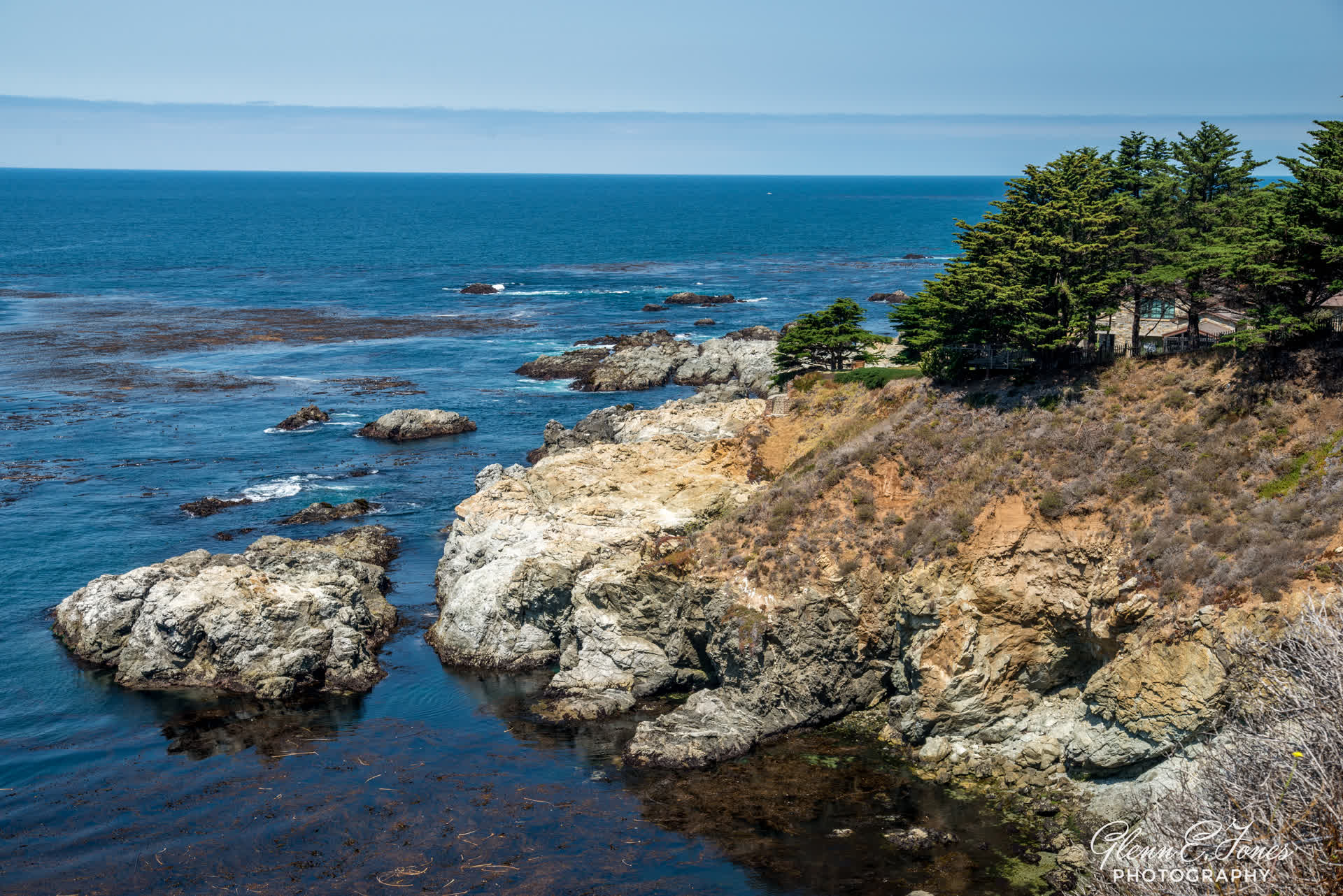
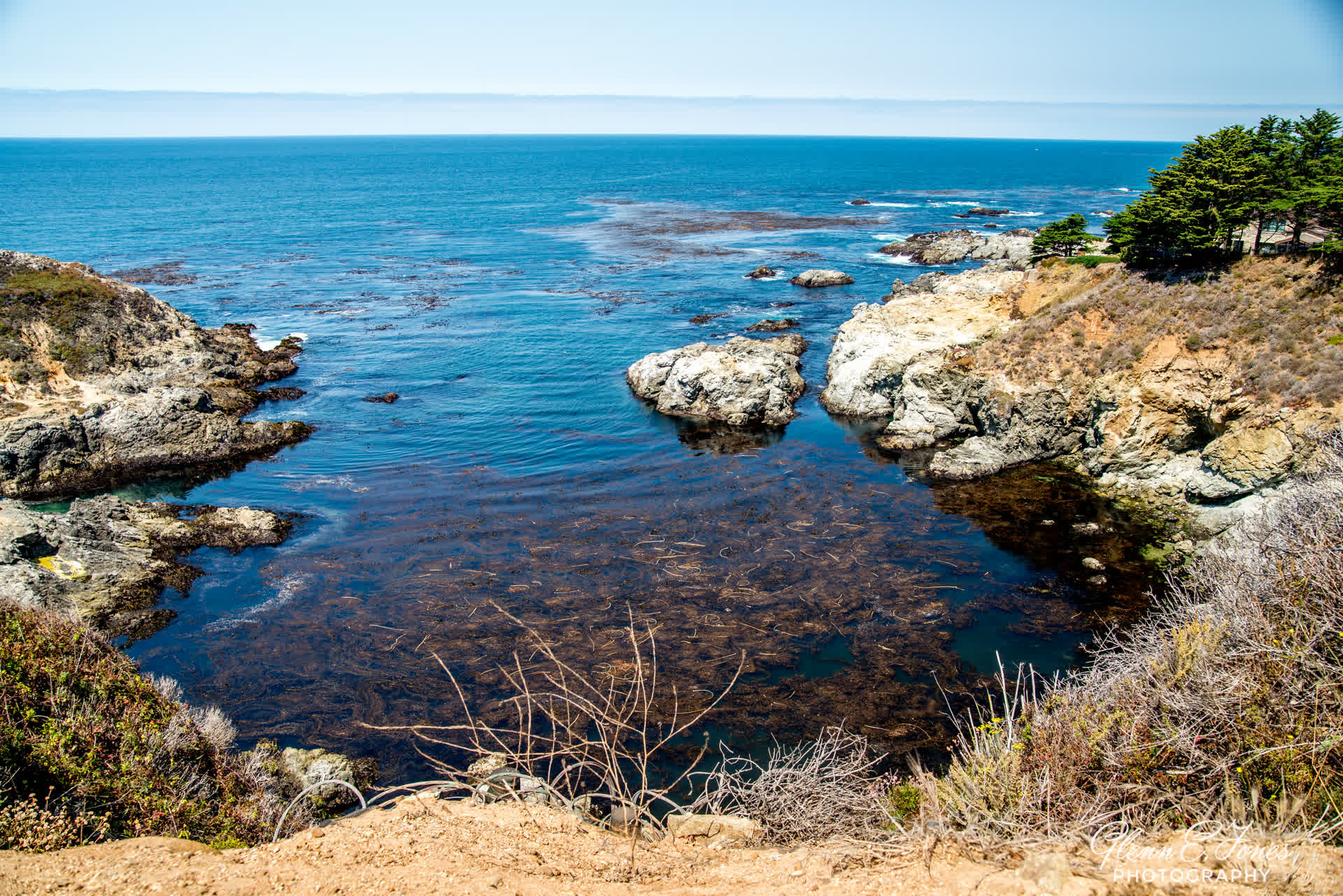
The coastal areas surrounding Pigeon Point light station are rich with life. Marine mammals, such as whales and seals, can be seen regularly from Shore as they passed beyond the surf. The intertidal zone along this part of the coast, particularly the rocky reefs that flank the light station, contains a diverse and numerous variety of plant and animal life. the site is now home to a hostel for travelers.
Shortly after arriving, I noticed a lot of photographers around. At first I thought we all had the same great idea. I later learned this was a scheduled “field trip” for a San Francisco based photography class. They would spend the evening doing astro-photography (a skill slightly beyond my current intelligence level). I watched them gather, go over equipment needed, and chat among themselves. As for me, I wandered off, taking photos and talking to some of the 20-somethings staying at the Hostel. I’d never stayed in one of those, and was curious about the interest in that type of sleeping accommodation.
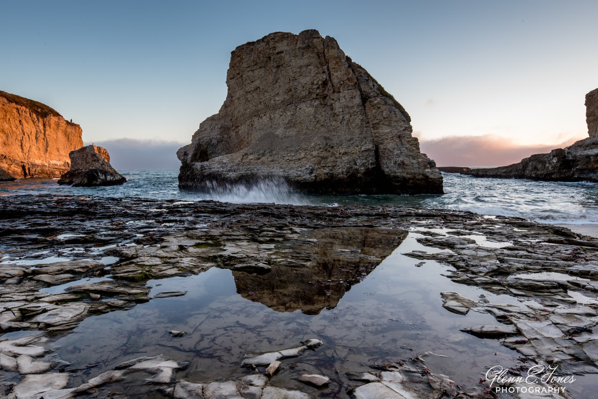
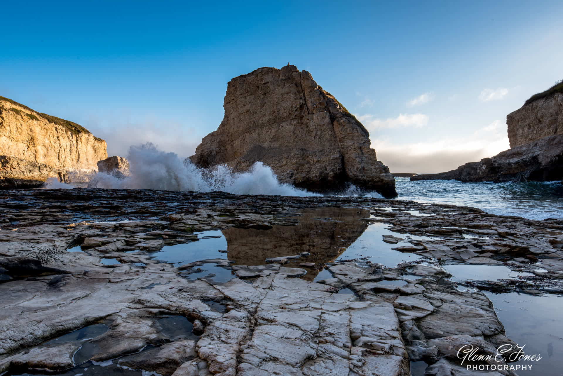
In Search of the Shark Fin
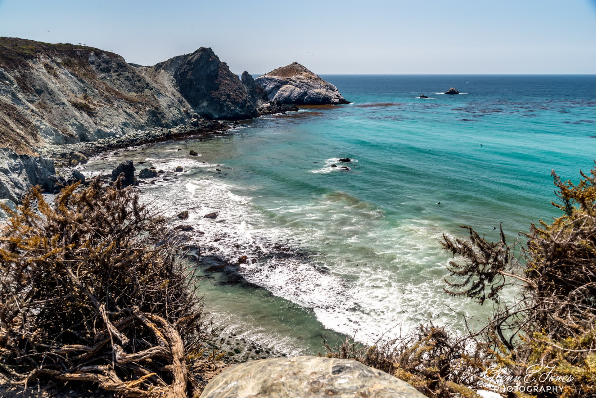
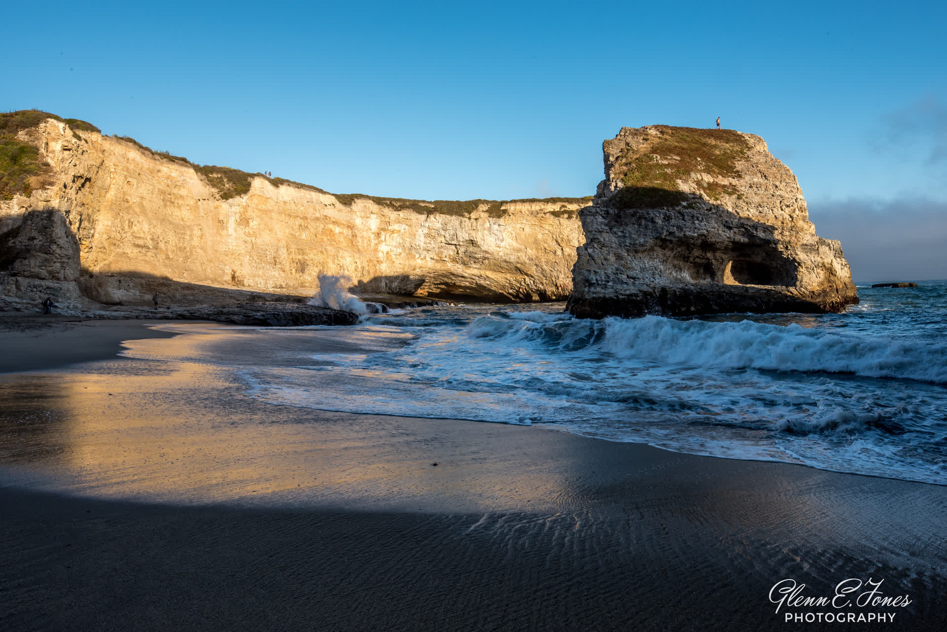
Exploring Pigeon Point Lighthouse was a humbling experience. Knowing this was one of the oldest (and tallest) lighthouses on the west coast reminds us how long things last if they are built well. It took years to build, yet a mere second compared to the millennia it took to carve this amazing coast. Departing, I pulled the rental car back onto the PCH heading south. Thankfully, few cars were on the road at the time. This would allow me to slowly marvel at the changing coastline while driving below the speed limit. Next stop, shark fin cove. My GPS said I was 20 minutes away but I’m told this was a difficult place to spot and I could easily drive right by and never see a thing. What I was looking for was a gathering of parked cars on the side of the road, basically in front of nothing. It would likely be my only hint of what was beyond the dunes. About 25 minutes later I saw those cars lined along abandoned railroad tracks. I pulled over, got my camera gear and walked about 10 yards looking to my right, at the same time my mouth dropped wide open. A small island looking like a shark fin jetting out of the ocean! The beach below, full of what I would best describe as hippies (or millennials) rolling so called man-made cigarettes and watching the waves.
Beginning my steep descent to the beach, all forms of “cool” were violently stripped away when I lost my footing on the root strewn narrow path, skidding to the bottom like an out of control turtle going over a fast moving waterfall. What made matters worse: the lone beautiful woman my age saying, “Mr. are you ok?” Just call the medical helicopter and fly what’s left of my pride back to the hotel and get me out of here, STAT!
Recovering my dignity and brushing off the ground-in dirt from the “butt” of my Levi’s, I head off to the sound of the sea and the amazing images of the cove and take photos. Whatever it took to distance myself from the embarrassment of these last few moments. Just ahead, a horseshoe shaped cove with a jagged shark fin in the middle, with the Pacific Ocean just beyond. The people on the beach were preparing tents and bonfires for a night of fun. I took a series of photos before noticing the crowd cheering. A lone man was climbing the shark fin! Keep in mind the currents were strong here and being raked against the jagged rocks just below the surface was a real possibility. Accomplishing this feat by reaching the top, it was now time to climb down. Keep in mind, this man didn’t have a clue how to make that happen. I kept expecting David Hasselhoff to round the corner (in slow motion) with the BayWatch crew to save the day. When that didn’t happen, the man slowly crawled down the jagged rock and dived back into the sea. He waded ashore after fighting the swift current bruised and slightly bloody, but a hero to his buzzed friends. His 15 minutes of fame were about up. The sun was now beginning to drop as the tide crept in. It was also time for me to ascend that slippery path, that wounded my pride just an hour earlier. I wanted to catch the vista from the top, before the sun dipped below the horizon. I stood there, thinking of my children, career, and the people I’m honored to call friend. Darkness began to assert itself along with the evening fog, bringing this day to a rapid close.


The drive back to Monterey was quiet as the sea fog slowed this trek to a crawl. Ted Talks was on NPR weekend, with another inspiring story to challenge the depths of my mind. Meanwhile, dining was quiet, even though I did meet a local couple who call this area home. Despite my best effort not to eat the peas I didn’t order, they brought me up to speed on all things Monterey. Among other things, a Jazz and Blues festival was scheduled for the following weekend. Better planning going forward, perhaps. Later sleep came quickly, satisfied with my days exploration. Tomorrow, back to Houston and the mountains of professional and personal reality waiting for me, upon arrival.
It took millions of years to carve this amazing coastline. While our time of discovery is remarkably short, it’s ironic how different we view exploring, depending on our life’s path.
“Tho much is taken, much abides…”
~ Alfred Lord Tennyson, Ulysses 1842
~ “M,” Judi Dench, Skyfall 2012
Courtesy: Columbia Pictures
Don’t forget to tell someone you love them, you might make their day. To the handful I’m fortunate enough to call “friend:” Stephen Davis, Dwayne Blake, Cedric Jamerson, Henry Green, Terry Tabb.. and of course my dad, Wilbert Jones.
Thank you.
Glenn ~”The Accidental Tourist”
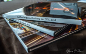 The prices start at $59.99 for a 20-page book...